Karystia Hiking
The Antiquities of Karystos
The abandoned settlement of Galana
The Drakospito of Oche Mt.
The Demosari gorge
The Agios Demetrios Gorge
The Platanistos village and Potami Beach
Amygdalia to Evangelismos
Drakospita, quarries, and Acropolis of Styra
The Megalo Nisi of Petalioi islands
The Antiquities of Karystos
ROUTE: Myloi, Kylindroi, Roman Aqueduct, Myloi, Kokkinokastro, Palia Chora
DISTANCE: 9 km
GPS MOVING TIME: 3 hr
ALTITUDE DIFFERENCE: 400 meters
LEVEL: 2
SUN EXPOSURE: 95%
TERRAIN: thick low vegetation 50%
Karystos existed as a city-state prior to classical antiquity. Studying its history one can gain a vast knowledge of Mediterranean and Balkan history as shaped by the antagonisms of each period’s powers.
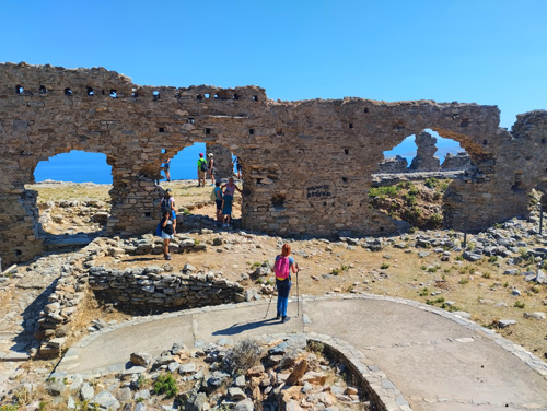
The hike begins at location Myloi, a past grain processing by water mills center, and heads towards the Roman quarry “Kolones”. From this quarry were extracted monolithic columns moved afterwards to the shore and transferred to Rome, Constantinople and other locations of the Empire. The spot offers a great view of the Karystos golf, the Castle, the aqueduct, and the surrounding villages.
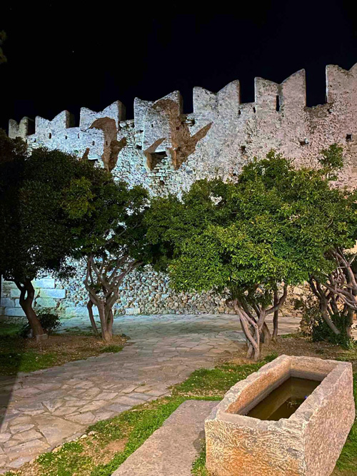
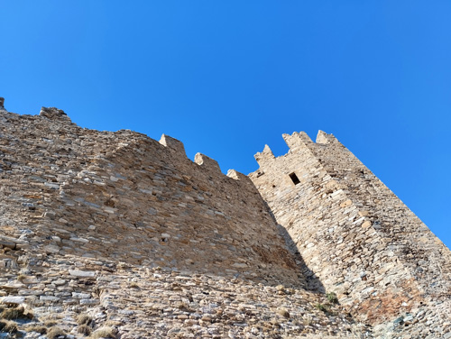
Following the same path downhill, the hike heads towards the Roman aqueduct “Kamares”, a typical arched Roman construction of the kind, meant for transferring water from the nearby spring “Montofoli” to the Fortress. Next stop is the Fortress “Kokkinokastro” or “Castello Rosso”, with multiple layers of construction and used by Romans, Lombards, Catalans, Venetians, and Ottomans.
Last location of this hike is Palia Chora (Old City), where the remains of the Palace of the Eastern Roman (Byzantine) Prefect, stand.
The full extent of the trail is 9 km and the altitude difference is 400 meters (250, 400). The approximate hiking time is 4 hours.
The time needed for the activity as described along with transfers, breaks, and a meal at a local tavern is about 8 hours. There is the possibility of limiting the hiking distances.
High top shoes, long pants, hat, sun protection, 1+Lt water, trekking poles. From June to September, because of the heat, one may use double the calories than normal, therefore, one should be prepared adequately and even not take the risk in case of existing health issues.
The activity is available throughout the year.
Call EuKarystia for booking one of our experienced trail escorts, or for planning and organizing your single or multiple day activities.
The abandoned settlement of Galana
ROUTE: Paradeisi, Agia Anna, Galana, Liotrivi, Paradeisi
DISTANCE: 3.5 km
GPS MOVING TIME: 1 hr
ALTITUDE DIFFERENCE: 80 meters
LEVEL: 1
SUN EXPOSURE: 80%
TERRAIN: thick low vegetation 50%
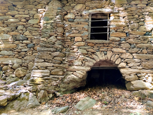
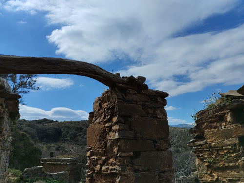
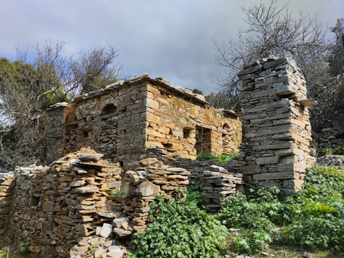
Galana is an abandoned settlement close to the village Paradeisi. It is located on the hill of the southeast side of a small amphitheater-shaped valley. Visiting Galana offers a unique experience of imagining the way of life of the family that lived there perfectly autonomous from the rest of the world as most of the villagers of the area till the mid seventies. It is said that the only goods people needed from the market were sugar, coffee and tobacco.
Galana has been abandoned and derelict since the middle of the 20th century. The last house was built in 1946. The remaining houses, preserved as ruins, were built towards the end of the 19th century.
According to the testimonies of the oldest Marmari inhabitants, Galana had 100 inhabitants in the first half of the 20th century. At the moment we do not know the date of creation of the settlement, however the area, due to its relief, has always been and, to a certain extent, still remains, the center of agricultural and livestock activities.
The distance to Galana and back from Paradeisi is 3.5 km and the altitude difference is 80 meters. The approximate hiking time is 2 hours. The time needed for the activity along with transfers, picking up a refreshment or a snack from Paradeisi, and breaks is about 3 hours.
High top shoes, long pants, hat, sun protection, 1 Lt water, trekking poles. From June to September, because of the heat, one may use double the calories than normal, therefore, one should be prepared adequately and even not take the risk in case of existing health issues.
The activity is available throughout the year.
Call EuKarystia for booking one of our experienced trail escorts, or for planning and organizing your single or multiple day activities.
The Drakospito of Oche Mt.
ROUTE: The Drakospito of Mt Oche, Kastanologgos, Katafygio, Profitis Elias, Drakospito, Petrokanalo
DISTANCE: 5 km
GPS MOVING TIME: 1.5 hr
ALTITUDE DIFFERENCE: 360 meters
LEVEL: 2
SUN EXPOSURE: 100%
TERRAIN: thick low vegetation 10%
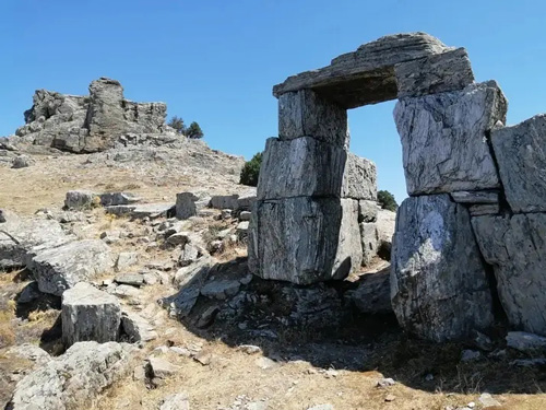
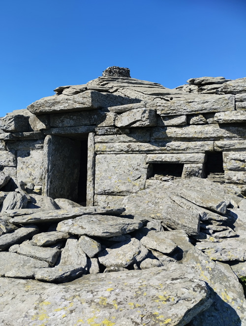
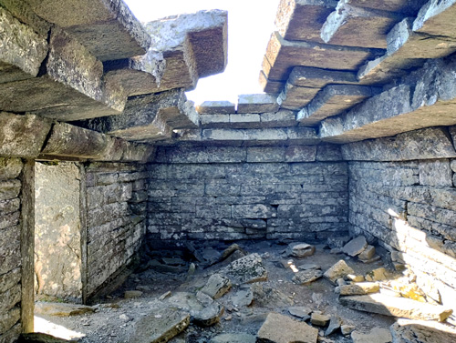
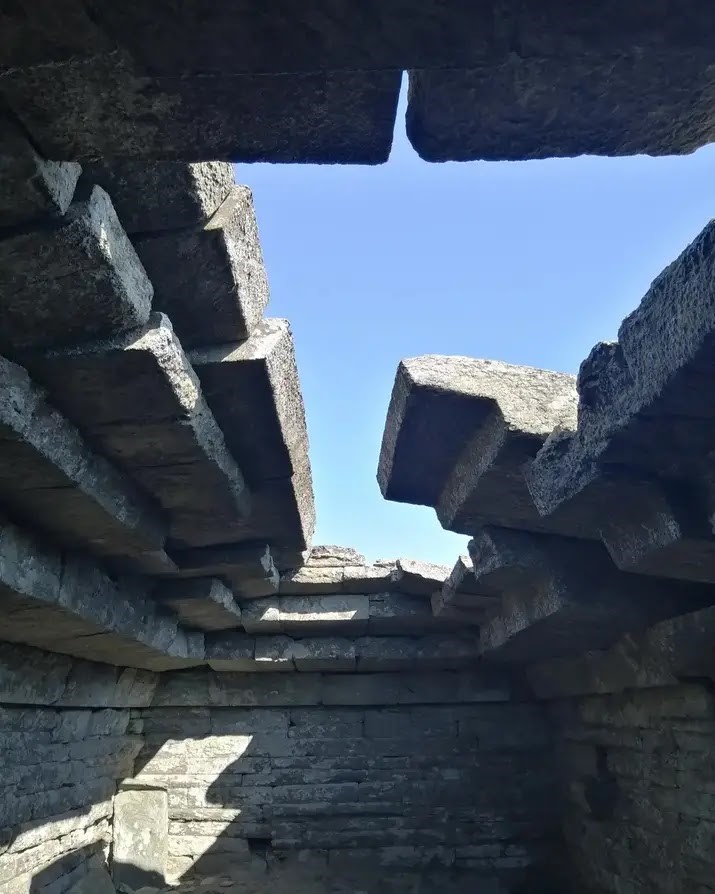
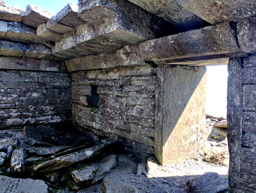
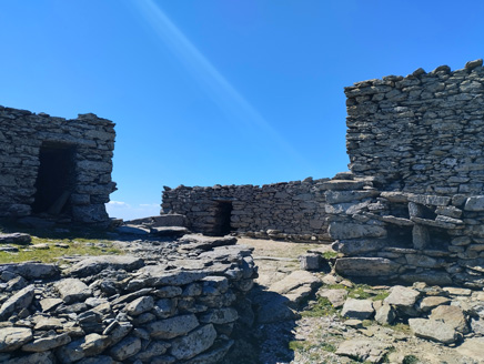
The Dragon House is a megalithic ancient construction of unknown origin right under the top of the 1.400 meters high mountain Oche. There is evidence that among other uses at some point served for the worship of Zeus and Hera. It is not defined though if this was its original purpose.
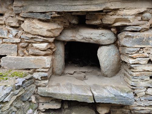
The huge stones are mantled with precisement and the several tonnes of each roof stone make the construction a technical miracle. There are signs that at a certain historical period there had been attempts of dismantling it, as happened with many antiquity monuments during the attempt to erase idolatry.
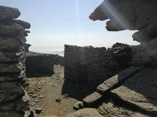
About 50 meters south there is a complex of constructions, probably of most recent years, that have, and still are, being used by Orthodox Christians for religious purposes and refuge. These are also impressive regarding their technical and aesthetic characteristics.
The view all around is breathtaking, and one can observe the east coast of Attica, along with numerous Cycladic Islands such as Kea, Andros, Gyaros etc.
The trail is 5 km and the altitude difference is 360 meters. The approximate hiking time is 2.5 hours. The time needed for the activity along with transfers and breaks is about 6 hours.
High top shoes, long pants, hat, sun protection, 1 Lt water, trekking poles. From June to September, because of the heat, one may use double the calories than normal, therefore, one should be prepared adequately and even not take the risk in case of existing health issues.
The activity is available throughout the year.
Call EuKarystia for booking one of our experienced trail escorts, or for planning and organizing your single or multiple day activities.
The Demosari gorge
ROUTE: Petrokanalo, Demosari, Lenossaioi, Kalianou beach
DISTANCE: 11 km
GPS MOVING TIME: 3.5 hr
ALTITUDE DIFFERENCE: 850 meters
LEVEL: 2
SUN EXPOSURE: 40%
TERRAIN: thick low vegetation 10%
Demosari gorge is a very well known route that used to connect the northern villages of Oche with Karystos. Milk products, chestnuts, cherries, wool and leather, sheep and goat herds were transferred through this trail, all year round. Signs of its past glory are the stone paved remnants that used to allow the mules and the donkeys to carry the goods back and forth, at often extreme slopes.
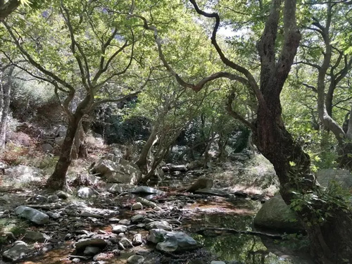
This northern part of Oche Mt. traps the sea moisture brought by the north winds, making the area fertile and rich in vegetation.
The visitors throughout this hike will experience unique natural beauties intriguing all of their senses.
The distance from Petrokanalo to Lenossei is 8 km and the altitude difference is 800 meters. Hiking time is approximately 3.5 hours. 3 additional kilometers (and 45 minutes) on dirt road should be considered in order for the group to reach the accessible by the bus location.
The time needed for the activity along with transfers, breaks and swimming at the tubs and Kalianou beach is about 10 hours.
High top shoes, long pants, hat, sun protection, 2 Lt water, trekking poles. From June to September, because of the heat, one may use double the calories than normal, therefore, one should be prepared adequately and even not take the risk in case of existing health issues.
The activity is available throughout the year.
Call EuKarystia for booking one of our experienced trail escorts, or for planning and organizing your single or multiple day activities.
The Agios Demetrios Gorge
ROUTE: Agios Demetrios spring, Schenodavlia beach
DISTANCE: 6 km
GPS MOVING TIME: 2 hr
ALTITUDE DIFFERENCE: 330 meters
LEVEL: 2+
SUN EXPOSURE: 90%
TERRAIN: thick low vegetation 20%, extreme heights
A magnificent trail connecting the village of Agios Demetrios to the seashore.
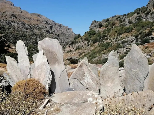
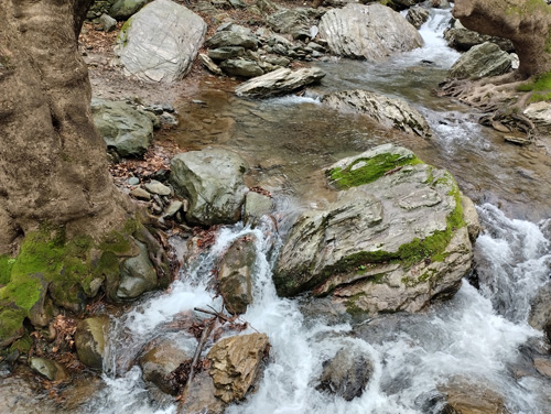
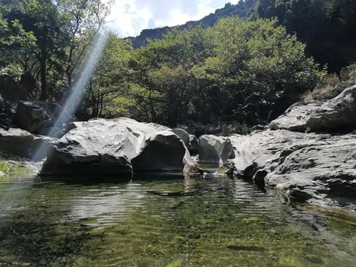
An impressive landscape formed by gigantic rocks and cliffs, characteristic of the area, surrounds the clearwater stream flowing all year round towards the sea. Each rock could be a castle by itself or a gigantic mythical figure.
The trail follows safely the left bank of the stream, a few meters to a few dozens meters away from it.
The trail is 6 km and the altitude difference is 330 meters. The approximate hiking time is 3.5 hours. For the first 3.8 km the path moves up and down around the elevation of 250m until it leads downward towards the sea.
The time needed for the activity along with transfers, picking up a snack from Paradeisi, breaks, and swimming, is about 8 hours.
High top shoes, long pants, hat, sun protection, 2+ Lt water, trekking poles. From June to September, because of the heat, one may use double the calories than normal, therefore, one should be prepared adequately and even not take the risk in case of existing health issues.
The activity is available throughout the year.
Call EuKarystia for booking one of our experienced trail escorts, or for planning and organizing your single or multiple day activities.
The Platanistos village and Potami Beach
ROUTE: Platanistos Waterfall to Epanochori
DISTANCE: 4.5 km
GPS MOVING TIME: 1.5 hr
ALTITUDE DIFFERENCE: 155 meters
LEVEL: 2
SUN EXPOSURE: 70%
TERRAIN: thick low vegetation 50%
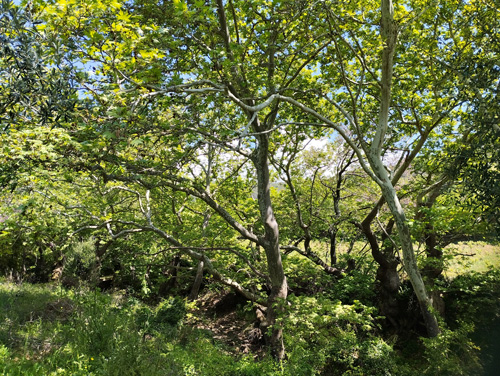
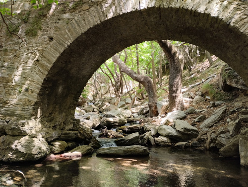
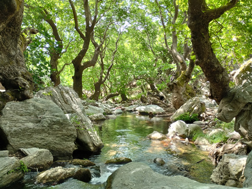
Platanistos is a scenic village at the East slopes of Mt. Oche, hiding its treasures inside thick vegetation. Ancient trails, all of them important transferring roots of the past, waterfalls, stone bridges and watermills. An important hub that used to connect Myloi (Karystos) to the Kafereas villages. The main water stream leads all the way to the magnificent beach Potami.
Starting from Platanistos there is a net of various length trails, all of them of great beauty and variety.
The suggested trail is 4.5 km and the altitude difference is 155m. The approximate hiking time is 2.5 hours.
The time needed for the activity as described, along with transfers, breaks, bathing at the tubs, driving to Potami beach, swimming and a dinning at a local tavern is about 9 hours.
High top shoes, long pants, hat, sun protection, 1+ Lt water, trekking poles. From June to September, because of the heat, one may use double the calories than normal, therefore, one should be prepared adequately and even not take the risk in case of existing health issues.
The activity is available throughout the year.
Call EuKarystia for booking one of our experienced trail escorts, or for planning and organizing your single or multiple day activities.
Amygdalia to Evangelismos
ROUTE: Amygdalia, Zacharia beach, Thymi, Archamboli, Evaggelismos
DISTANCE: 9 km
GPS MOVING TIME: 3 hr
ALTITUDE DIFFERENCE: 400 meters
LEVEL: 2+
SUN EXPOSURE: 95%
TERRAIN: thick low vegetation 70%
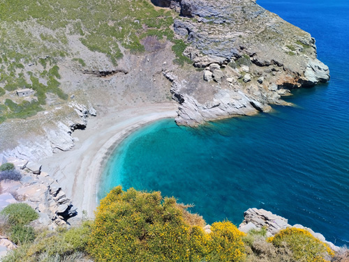
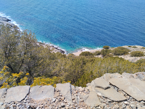
The trail towards Archamboli begins at the village Amygdalia and goes through sites with magnificent views to the sea, rocky cliffs, gorges, and rich Mediterranean vegetation. The first stop takes place at the Zacharia beach with its fresh water stream all year long. Towards Thyme, the walk passes through more intense natural sceneries until one reaches the breathtaking scenery of Archamboli. Moving west, the hike ends at the village Evangelismos.
The distance from Amygdalia to Evangelismos is 9 km and the altitude difference is 400 meters. Walking time is about 3 hours.
The trail is 9 km and the altitude difference is 400 meters. The approximate hiking time is 5 hours. The path follows the coastal anaglyph by continuοus up and downs.
The time needed for the activity along with transfers, picking up a snack from Paradeisi, breaks, and swimming, is about 12 hours. There is the possibility of limiting the hiking distances to 5.5km in favor of spending time at the beach Archamboli (accordingly, altitude difference 260m, hiking time 2.5 hours).
High top shoes, long pants, hat, sun protection, 3 Lt water, trekking poles. From June to September, because of the heat, one may use double the calories than normal, therefore, one should be prepared adequately and even not take the risk in case of existing health issues.
The activity is available throughout the year.
Call EuKarystia for booking one of our experienced trail escorts, or for planning and organizing your single or multiple day activities.
Drakospita, quarries, and Acropolis of Styra
ROUTE: Drakospita, quarries, Acropolis Armenon, Pyli, Drakospita
DISTANCE: 5 km
GPS MOVING TIME: 1.5 hr
ALTITUDE DIFFERENCE: 350 meters
LEVEL: 2
SUN EXPOSURE: 75%
TERRAIN: thick low vegetation 25%
This short hike of, though, great importance and beauty, starts at a complex of stone constructions called Drakospita (dragon houses). These constructions, that are still in use by shepherds for their animals, have excited the fantasy of the locals for centuries because of their megalithic structures and the irrelevance to any other known past construction.
Many fables surround the Drakospita referring of course to dragons and village girls being hunted by them for their love. The original use of Drakospita has probably been for worshiping gods. Some findings from their interior are presented at the National Archeological Museum of Karystos.
The hike continues through a series of ancient stone quarries ending on a ridge that leads to the Acropolis of Styra. The Castle of Armenion (“Akontion” during antiquity) has been used continuously since antiquity, and was abandoned only during the 17th century. The view from this 628 meter hilltop offers an imaginary reconstruction of life through 3 millennia of raging wars and continuous conquests of the narrowest part of island Evia.
The circular route is 5 km and the altitude difference is 350 meters. The approximate hiking time is 2.5 hours. The time needed for the activity along with transfers, picking up a refreshment or a snack at Styra, and breaks, is about 4 hours.
High top shoes, long pants, hat, sun protection, 1 Lt water, trekking poles. From June to September, because of the heat, one may use double the calories than normal, therefore, one should be prepared adequately and even not take the risk in case of existing health issues.
The activity is available throughout the year.
Call EuKarystia for booking one of our experienced trail escorts, or for planning and organizing your single or multiple day activities.
The Megalo Nisi of Petalioi islands
ROUTE: Panagitsa, Vassiliki Odos, Vassiliko, Megali Rossa, Mikri Rossa, Panagitsa
DISTANCE: 16 km
GPS MOVING TIME: 4 hr
ALTITUDE DIFFERENCE: 225 meters
LEVEL: 2
SUN EXPOSURE: 95%
TERRAIN: thick low vegetation 50%
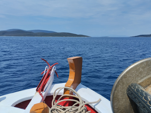
The Megalo Nisi is the biggest of the Petalioi islands. It was owned by the former royal family and partly by dependent field workers. At the end of the 19th century, King George requested a perimetrical road for his chariot entertainment rides. Small stone bridges, carved cliffs, beautiful Mediterranean vegetation and sea views, wild beaches, and the remains of peasant houses offer a unique experience to the visitor.
The full extent of the trail is 16 km and the altitude difference is 225 meters. The approximate hiking time is 6.5 hours.
The time needed for the activity as described along with boat transfers, breaks, and a meal, is about 10 hours.
There is the possibility of limiting the hiking distance to 9 km in favor of spending time at the beach (accordingly, altitude difference 60m, hiking time 4.5 hours).
High top shoes, long pants, hat, sun protection, 3 Lt water. From June to September, because of the heat, one may use double the calories than normal, therefore, one should be prepared adequately and even not take the risk in case of existing health issues.
The activity is available throughout the year.
Call EuKarystia for booking one of our experienced trail escorts, or for planning and organizing your single or multiple day activities.


